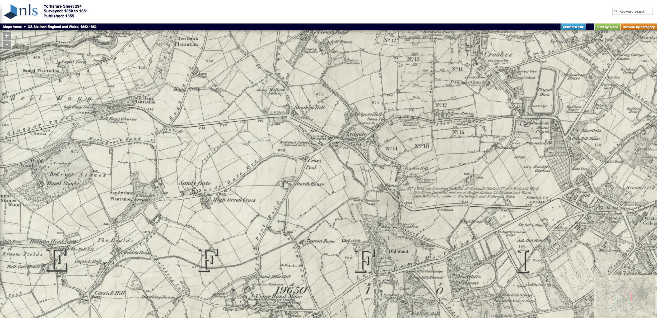
Reproduced by permission of the National Library of Scotland
Crosspool as it was 160 years ago has been revealed on a set historic maps.
The Sheffield maps were drawn at various dates since 1850 and are available for viewing on the National Library of Scotland website.
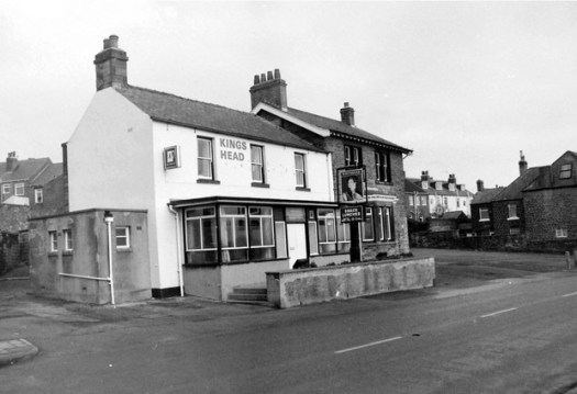
The 1850 Crosspool map (PNG, 3.3MB) shows just a handful of dwellings around the Lydgate junction and Stephen Hill. You can also see landmark buildings that have since been knocked down including Lydgate Hall and The Kings Head pub.
View the full map on the National Library of Scotland website